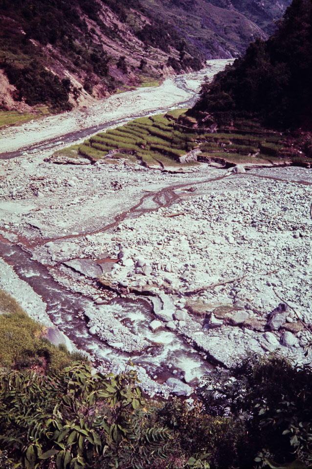
Caption: Date: 1971-09 Location: Goganpani, Dailekh Description: View of the intersection of the Bhairi River (lower right to center left) and Prajuli River (flowing down from upper right) after catastrophic monsoon flooding caused landslides to rip out khet on either side of both rivers and raise the river beds by about 30 feet—sweeping away two newly built swaying (cable) bridges as well as an older bridge leaving scant evidence that they had been there. Keywords: Alan Fairbank, Nepal Photo History Project, Peace Corp Photo History, flood, landscape, river, stream