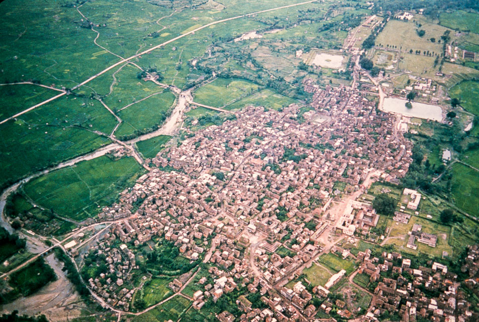
Caption: Date: 1970-1972 Location: Bhaktapur, Bhaktapur Description: Taken from an airplane, the top of the photo is toward the west. The road that cuts across the upper left side of the photo is the Araniko Highway. It skirted Bhaktapur on its way to Banepa and Dhulikhel. The larger pond in the upper right may be where the Kathmandu-Bhaktapur buses stopped. In the lower center is the 5-story Nyatapola Temple. The lengthy square in the lower right with the large building is the main square with the Malla palace. The river is the Hanumante River. Keywords: Jan Mascall, Nepal Photo History Project, Peace Corp Photo History, aerial view, landscape, town, village